Corrosion Map
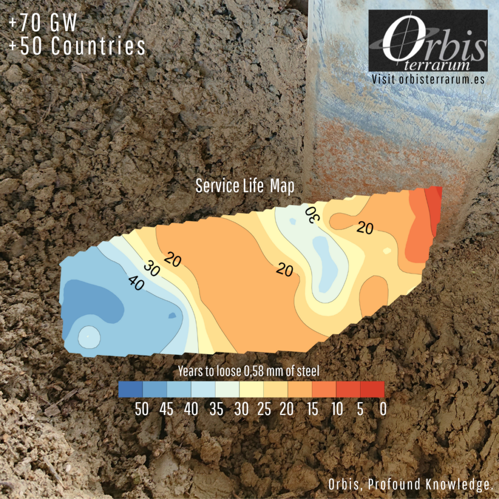
In a recent corrosion assessment study for a utility-scale PV plant in Spain, Orbis Terrarum developed what we now refer to as a Time Map: a zone-based overview showing how much time remains before corrosion significantly compromises the structural integrity of steel elements.
Rather than relying on assumptions or isolated measurements, the Time Map provides:
- A clear view of remaining service life by zone
- Data to prioritize O&M and CAPEX decisions
- A structured basis for mitigation planning
To build it, our Corrosion Assessment Departmen combined on-site inspections, corrosion diagnostics, and electrochemical measurements across the site. Soil, water, and oxide samples helped trace local corrosion dynamics, allowing us to compute corrosion velocities and group areas by remaining lifespan.
The result is a useful planning tool that translates technical data into timelines, helping asset operators manage degradation in complex environments.
If you manage PV infrastructure exposed to marine air, aggressive soils, or stray currents, this methodology may help you assess and act with greater precision.
Feel free to reach out if you’d like to explore the approach.
#OrbisTerrarum #Corrosion #PV #TimeMap #StructuralIntegrity #Electrochemistry #AssetManagement #SolarEngineering #MaterialsScience #O&M #GeotechnicalEngineering

